 中文版
中文版 English
Soil salt rapid tester
manufacturer:Shandong Horde Electronic Technology Co., Ltd.
Introduction:The manufacturer of Soil salt rapid tester「Horde Electronic」 has mastered the research and development technology of Soil salt rapid tester, with more than 10 years of experience in manufacturing Soil salt rapid tester. The quality is reliable, the detection accuracy is high, and the price competitive advantage of the source manufacturer is obvious. Welcome to call for more information.
Update time:2026-06-11
- Contact: Contact Information
- Phone:008619053605658
Product Recommendation
Product Details
Introduction:
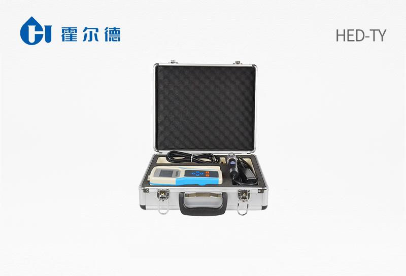
The soil in-situ salt rapid tester is a portable conventional measurement and analysis instrument with an integrated structural design. It can display soil conductivity and salt values at the same time. It consists of a portable host, sensor, software, etc. and is easy to operate.
Scope of application:
The instrument is widely used in dryland water-saving irrigation, precision agriculture, forestry, geological exploration, plant cultivation, greenhouse planting, water conservancy, environmental protection, scientific experiments and other fields.
Technical parameters:
Measurement range: 0-20ms/cmMeasurement accuracy: ±1%Resolution: ±0.01ms/cmOutput signal: 0~2.0V
Interchangeability accuracy: <2%Retest error: <1%Working temperature range: -40℃~85℃
Conductivity temperature compensation: built-in temperature compensation sensor, compensation range 0-50℃
Measurement principle and measurement method: soil conductivity AC bridge method
Soil is inserted into the soil in situ or immersed in the culture solution, water-fertilizer integrated nutrient solution for direct testing
Protection level: IP68 can be used for a long time when immersed in water
Operating environment: -40~85℃
Probe material: special anti-corrosion electrode
Sealing material: black flame-retardant epoxy resin
Installation method: fully buried or all probes are inserted into the measured medium
Default cable length: 2 meters, cable length can be customized as required
Connection method: pre-installed cold-pressed terminal
Dimensions: 45*15*145mm
Electrode length: 70mm
Power supply: lithium battery power supply, AC power supply Software: PC software is given for free
Outstanding performance:
Adopting integrated structure design, built-in GPS module, GPRS module, external SD card, it can accurately measure the geographical information of the measured location. In addition to displaying the measured environmental parameters and storage data, the interface can also display the latitude and longitude of the measuring point. Upload the environmental factor measurement data of the measured point with one click through the built-in GPRS. At the same time, the data can be directly exported to the computer through the external SD card.
The machine is small and beautiful, simple and convenient to operate, reliable in performance, and extremely convenient to carry in the field. After the host is connected to the sensor, the records can be stored manually or the sampling interval can be set arbitrarily through the host to automatically store the recorded data.
The large-screen Chinese LCD display tracks and records the values, number of groups, and low voltage alarms of each measured environmental factor throughout the process. The host has a built-in large-capacity memory that can store 300,000 data and has a power-off data automatic storage protection function.
After each sensor is inserted into the host, the host has an automatic recognition function, the sensor consistency is good, the sensor can be combined according to the needs, and the sensor interfaces with different parameters can be converted to each other, which has no effect on the measurement accuracy.
The instrument has a multi-channel automatic detection expansion function, which can realize the synchronous detection of multiple sensors connected at the same time.
The host computer software is powerful and can export the recorded data to the computer through the USB interface at any time, and can be stored as an EXCE table file to generate data curves for further data processing by other analysis software. It has the function of setting the coloring of the over-limit area and the color change warning of over-limit data, which can be used as a basis for environmental evaluation.
Product's Website:http://en.huoerd.com/trddlcdy/275.html


 Home
Home Phone
Phone Product
 Contact